Soil Investigation in Turkey: What to Check in the Report
What a soil investigation is, why it is mandatory in Turkey, what happens on site (boreholes, SPT, geophysics), how many boreholes the rules require and how the report shapes your foundation.
- Published
- Author
- Genç Avşar Hafriyat
- 8 min read
- 8 min read
What is a soil investigation and why is it mandatory?
Every building ultimately transfers its weight, and the forces generated in an earthquake, into the ground. A soil investigation (zemin etüdü in Turkish) establishes how deep, how thick and how strong the soil and rock layers are that will carry those loads, and the resulting report records it. The structural design, meaning the calculations and drawings for the load-bearing frame, is based on the values in this report.
The rules are set out in the Zemin ve Temel Etüdü Uygulama Esasları ve Rapor Formatına Dair Tebliğ, a communiqué on soil and foundation investigation procedures and report format, published by the Ministry of Environment and Urbanisation in the Official Gazette on 9 March 2019 and amended on 17 February 2021. Under the communiqué, a soil and foundation investigation is mandatory for the design, engineering, construction and supervision of buildings.
It does not only apply to new buildings. Investigations are also carried out when assessing existing buildings, identifying risky buildings and planning structural strengthening. The communiqué builds on the Türkiye Bina Deprem Yönetmeliği (TBDY 2018), Turkey's building earthquake code, which came into force on 1 January 2019. The soil class used in seismic design is determined under this code.
Who carries out the investigation?
A soil investigation is not a one-person job. The communiqué groups the work into categories and specifies which engineering disciplines must be involved. Under the 2021 amendment, Category 1 work on sites with local soil class ZA or ZB is done by geological engineers. Other Category 1 sites require geological and geophysical engineers, while Category 2 and 3 work is carried out jointly by civil, geological and geophysical engineers. The report is signed by the relevant engineering disciplines.
As the owner, your role is to commission an authorised, experienced team and make sure the report matches the project. Ask your municipality and the engineer preparing your project which category applies and which documents the permit process requires.
What happens on site: boreholes, SPT and geophysics
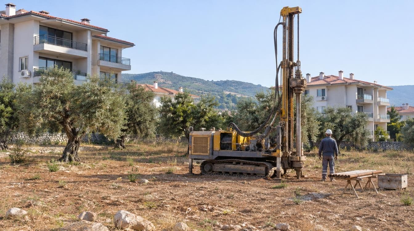
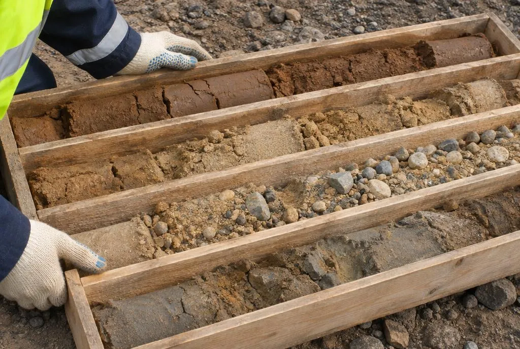
The most visible part of the investigation is drilling. A drilling rig bores a narrow, deep hole on the plot; every layer it passes through is logged and sampled. Once it reaches rock, cores, cylindrical samples cut from the rock, are recovered.
A Standard Penetration Test (SPT) is usually performed in the borehole. A hammer of standard weight is dropped from a set height to drive a sampler into the ground, and the number of blows needed to advance a set distance is recorded. The more blows, the denser or stiffer the soil. The communiqué lists field tests such as the SPT and the vane test among the methods used to determine the soil class.
Geophysical measurements record wave velocities without disturbing the ground and help to understand the area between boreholes. The communiqué also names investigating the presence and depth of groundwater and the liquefaction potential among the aims of geophysical work. Samples taken on site are tested in the laboratory as well, for example for grain size distribution, water content and strength.
| Method | What is done | What it adds to the report |
|---|---|---|
| Borehole drilling | A hole is drilled, layers are logged and sampled | Depth and thickness of layers, depth to rock |
| SPT | A sampler is driven into the soil by hammer blows | Numerical data on how dense or stiff the soil is |
| Geophysical survey | Wave velocities in the ground are measured | Data for the soil class, information between boreholes |
| Laboratory tests | Physical and mechanical tests on samples | Soil type and strength parameters |
| Groundwater reading | The water level in the borehole is measured | Data for basement, excavation and waterproofing decisions |
How many boreholes, and how deep?
The 2021 amendment sets out the number and depth of boreholes in detail. The main rules can be summarised as follows:
| Situation | Rule in the communiqué |
|---|---|
| Foundation footprint under 300 m², single block | At least 3 boreholes |
| Every additional 300 m² of footprint | 1 more borehole |
| Very small footprint | May be reduced with authority approval and geophysical support, but not below 2 |
| Multi-block development | At least 1 borehole per 300 m² under each block's foundation |
| Footprint over 1000 m² | May be planned with at least 5 boreholes, without exceeding maximum spacing |
For depth, the communiqué requires drilling from the foundation level to at least 1.5 times the width of the building, or to the depth at which the building's load no longer has a significant effect on the soil. If the drill reaches rock before the target depth, coring continues for at least another 3 metres, depending on the rock type. Where a rig physically cannot get onto the plot, drilling may take place outside it, at a distance set by the investigation team and approved by the authority.
What should you look for in the report?
The report is a technical document and its final interpretation belongs to the engineer. Still, there are a few key sections every owner should understand.
Soil class
TBDY 2018 divides ground into six local soil classes, ZA to ZF, based on the average properties of the top 30 metres. ZA stands for sound rock, and the ground gets weaker towards ZF. The class is determined using shear wave velocity (how fast a wave travels through the ground), SPT blow counts and, for clays, strength values. The soil class directly affects the earthquake forces the building is designed for.
Groundwater
The water level is measured in the boreholes. It determines whether a basement is feasible, whether the excavation will need dewatering and how the waterproofing should be designed. Groundwater levels can change with the seasons, so check when the reading was taken.
Bearing capacity and settlement
Bearing capacity is the load the ground can carry without failing; settlement is the downward movement of the building as the soil compresses under load. If one part of a building settles more than another, walls and slabs can crack. The report should assess both and give the values on which the foundation design is based.
Liquefaction
Liquefaction is when loose, water-saturated sandy soil loses much of its bearing capacity during an earthquake. This assessment matters especially on plots close to the coast or to stream beds. Check whether the report includes a liquefaction assessment and what it concludes.
How does the report shape the foundation?
The most tangible output of the report is the foundation recommendation. On firm ground, pad or strip footings may be enough. On weak ground the engineer may call for a raft foundation, a single slab spread under the whole building, piles reaching deeper load-bearing layers, or ground improvement. The structural engineer decides which solution fits, based on the report.
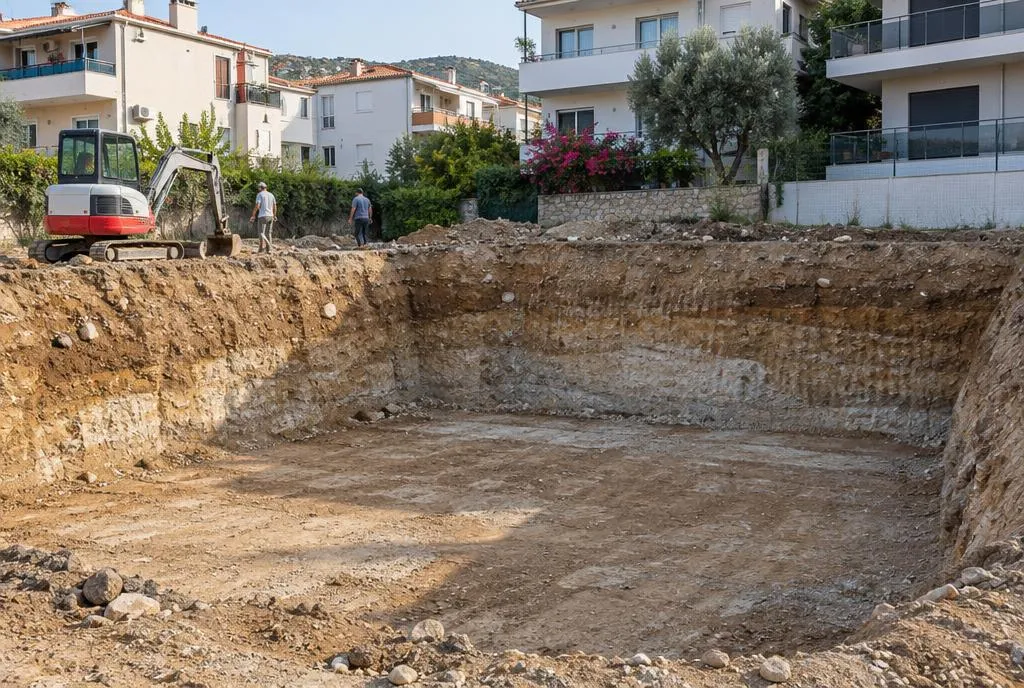
The report also directly affects the excavation. Excavation depth, how steep the cut slopes can be, whether shoring (a support system holding back the sides of the pit) is needed near neighbouring buildings and what to do about groundwater are all planned from this information. Our team, based in Bornova, İzmir, carries out foundation excavation with 2- and 5-tonne mini excavators, and we also work in Çeşme, Bodrum and Marmaris.
The ground also plays a decisive role in how an existing building behaves in an earthquake. We cover this in our article on how to tell if a building in Turkey is earthquake-resistant. Whether a specific existing building is safe can only be decided through an inspection by an authorised engineer.
Sources
- Zemin ve Temel Etüdü Uygulama Esasları ve Rapor Formatına Dair Tebliğ, Official Gazette, 9 March 2019, No. 30709
- Amendment to the communiqué on soil and foundation investigation, Official Gazette, 17 February 2021, No. 31398
- Türkiye Bina Deprem Yönetmeliği (TBDY 2018), Official Gazette, 18 March 2018, No. 30364 (repeat issue)
Frequently asked questions
Is a soil investigation mandatory in Turkey?
Yes. Under the communiqué on soil and foundation investigation procedures, an investigation is mandatory for the design, engineering, construction and supervision of buildings.
How many boreholes does a small detached house need?
For a single-block building with a foundation footprint under 300 m², at least 3 boreholes are required. For very small footprints this can be reduced with authority approval and geophysical support, but never below 2.
Who carries out the soil investigation?
Depending on the category of work, geological, geophysical and civil engineers are involved. For Category 2 and 3 work all three disciplines work together and sign the report.
What does the soil class mean?
TBDY 2018 divides ground into six classes, ZA to ZF, based on the average properties of the top 30 metres. ZA is sound rock and the ground gets weaker towards ZF; the class directly affects the design earthquake forces.
Why does groundwater matter in the report?
The water level determines whether a basement is feasible, whether the excavation needs dewatering and how waterproofing should be designed.
This article is for general information only. Decisions about your own project should be made with the licensed project designer and a qualified civil engineer.
- soil investigation
- boreholes
- SPT
- soil class
- foundations